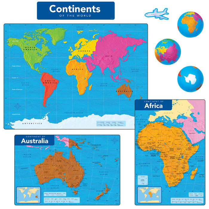
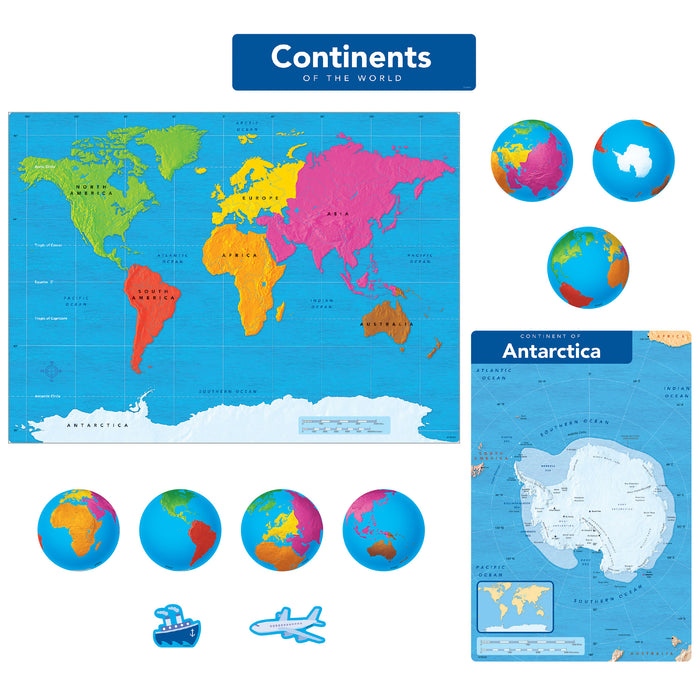

Continents of the World Learning Set
Learning Set
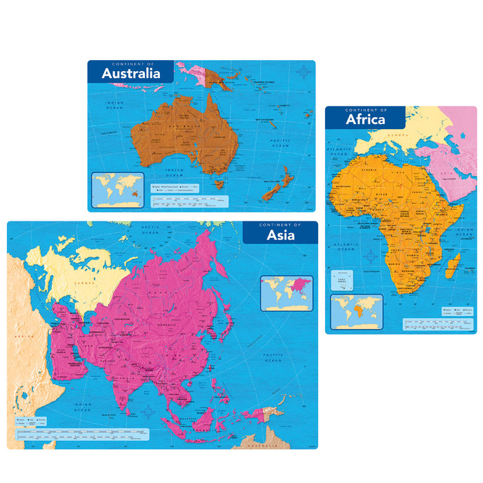
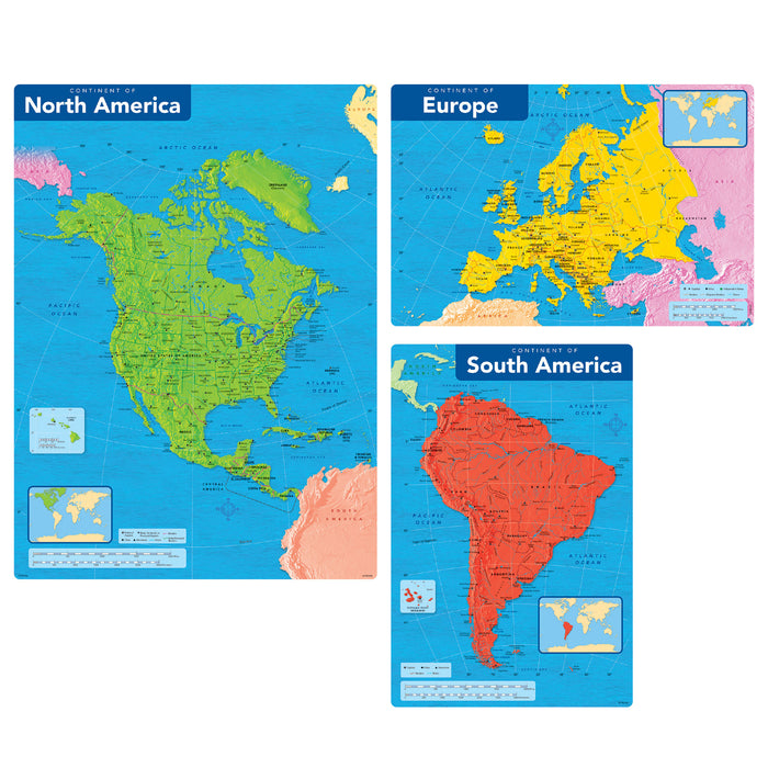
Get ready to explore the world! Introduce one continent at a time or display all at once to discover countries, capitol cities, physical geography, and more. Each continent poster includes country names and borders, plus a thumbnail image of its place in the world.
Use this interactive set in classrooms, homes, offices, and community centers to explore the world, map out trade routes and ancestry, refer to places in the news, assess student understanding and progress, and more. See the Learning FUN Ideas in the tab below for more inspiration!
-
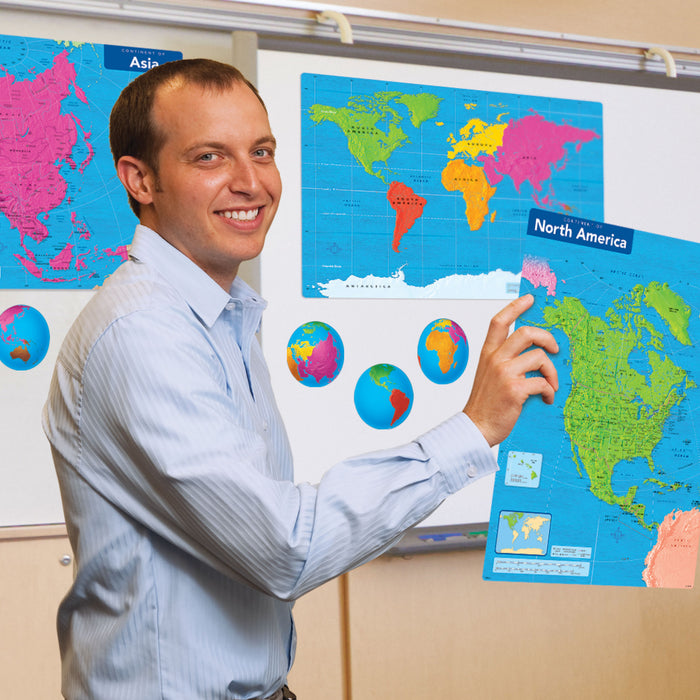
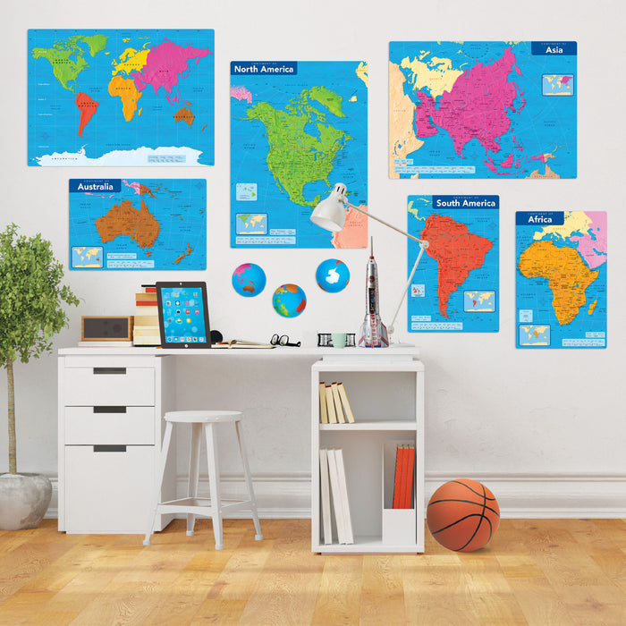
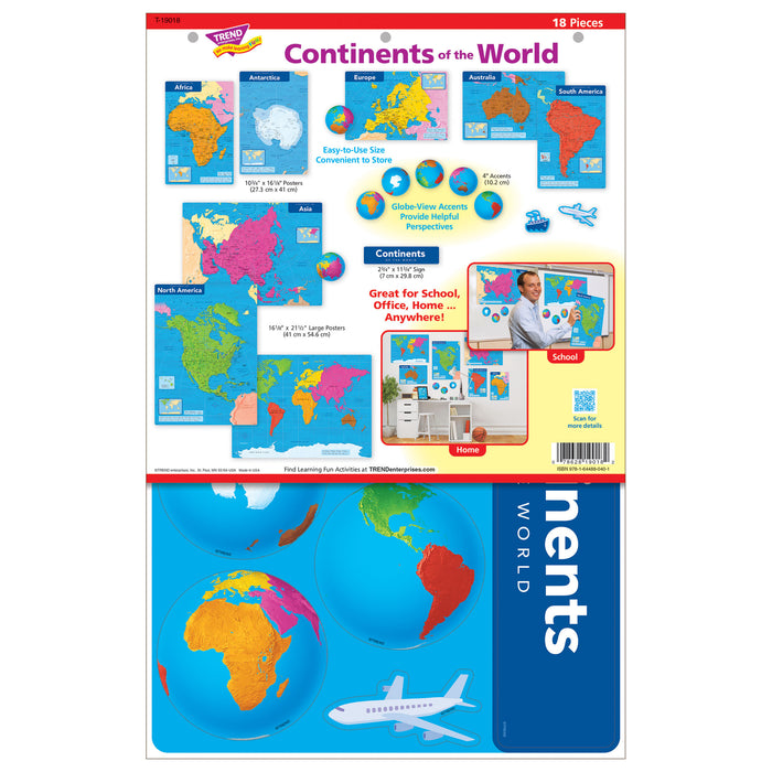
BIG LEARNING IN ANY SPACE – Charts are sized to easily arrange to fit any room environment. Display all at once, or one continent (Africa, Antarctica, Asia, Australia, Europe, North America, South America) at a time to match your learning needs. Additional pieces show all continents on one map, globe-view accents for perspective, an airplane, and a boat. Big enough for classroom use, and also convenient for office and home display.
-
WIDE WORLD OF DISCOVERY – Clear, easy-to-read maps include a wealth of detail! Explore the seven continents plus oceans, countries, capitol and other cities, and landforms. Details have been selected with an eye to current world events, points of discovery, science, and tourism, and to represent most of Earth's largest urban centers.
-
INTERACTIVE LEARNING, NOT JUST FOR KIDS – Versatile pieces are sturdy and sized right to reinforce interactive activities for class-wide, small group, and individualized learning. This Learning Set is full of hands-on opportunities. Use the ideas in the Learning FUN tab below to get started. Clean design also lends itself to use in business meetings and travel planning. Plus, the maps make a great enrichment tool for English-language learners and story starters for senior care facilities.
-
EASY STORAGE – Use posters individually or all at once. It's easy to store extras back in the bag. It reseals to keep your set organized and ready anytime. The largest posters are just over 21 inches, so they won't need specialized storage.
-
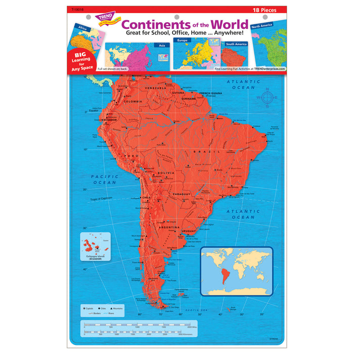
SET INCLUDES – 18 pieces: 7 continents, world map, header, 7 globe accents, plus airplane and boat travel accents; largest maps 16⅛ inches x 21½ inches
-
MADE IN USA – All TREND Learning Sets are quality-tested to meet product safety standards and are all proudly made in the USA.
Specifications
- Durable, reusable paper
- Photos for real-life learning
- Package reseals for easy storage
- 18 pieces: 7 continents, world map, header, 7 globe accents, plus airplane and boat travel accents; largest posters 16⅛ inches x 21½ inches
- Made in USA
Learning FUN Ideas
Enjoy these activity ideas for lots of FUN learning about the Continents:
-
Explore a Continent – Let's explore the world! With pieces from Continents of the World Learning Set as reference, ask individuals or small groups to select a continent to research. There's a "world" of opportunity: exploring countries, geography, languages, food, cultures, government, exports, and more. Once research has been completed, have groups share their discoveries with your class.
-
Learn About Your Ancestry – Did your family travel from around the world to get to where you currently live? Learn about your heritage and family origins. Using the Continents of the World Learning Set, map out where your family came from, including anywhere they settled along the way to where your live now.
-
It's a Wonder-Full World! The world has so many wonders to explore. Where to begin? Select a Wonder (Ancient, New, Natural) you'd like to learn about. The Pyramids of Giza? Machu Picchu? The Great Barrier Reef? Find its location on the Continents of the World map. Then, dig into what makes it special or appealing to you. Prepare to share what you've discovered with others: draw a picture, design a travel brochure, or create a multimedia presentation.
- Map the World! Provide students with a copy of The Continents of the World Blank Map Free Printable. Test their knowledge: Can they label each continent and ocean? Have them compare their map to the Continents of the World Learning Set. For an additional challenge, learn and label the Equator and the Tropics of Cancer and Capricorn, and identify in which continent (or continents!) a country is located.